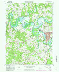
1964 Map of Blairsville
USGS Topo · Published 1982About this map
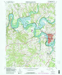
The Conemaugh River Lake dominates the landscape west of Blairsville, formed by the massive Conemaugh Dam at Bow Ridge. This post-war era survey illustrates the complex relationship between industrial extraction and flood control in Western Pennsylvania. The presence of numerous gas wells and a Conveyor Mine north of Keystone State Park highlights the region's active energy economy. A curious piece of local history is preserved in the Old Railroad Grade that skirts the lake's northern edge, a remnant of former transit lines that once connected riverside communities like Bairdstown and Torrance. Further south, the map details the expansive grounds of the Torrance State Hospital and isolated rural markers like Old Salem Ch and Mt Carmel Cem, which anchor the small crossroads settlements of Derry and Burrell townships.
Find a feature on this map
38 named features on this map. Tap any name to fly to it.
Don’t see what you’re looking for? This feature index may not catch every label — zoom into the map to look around manually.
Map Details
Editions of this 1964 Blairsville Map
5 editions found
Other maps of this area

1900 · Latrobe
USGS Topo · 1:62,500

1902 · Latrobe
USGS Topo · 1:62,500

1902 · Indiana
USGS Topo · 1:62,500

1902 · Elders Ridge
USGS Topo · 1:62,500

1903 · Latrobe
USGS Topo · 1:62,500

1904 · Elders Ridge
USGS Topo · 1:62,500

1920 · New Florence
USGS Topo · 1:62,500

1921 · New Florence
USGS Topo · 1:48,000

1922 · New Florence
USGS Topo · 1:62,500

1944 · New Florence
USGS Topo · 1:62,500
Featured Places
- Blairsville, PA
- Black Lick Township, PA
- Burrell Township, PA
- Livermore, Derry Township
- Conemaugh Township, PA