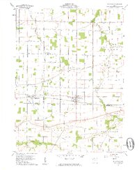
1960 Map of Bloomdale
USGS Topo · Published 1961About this map
Bloomdale serves as a central hub on this 1960 topographic survey, situated at the intersection of the Baltimore and Ohio railroad and a grid of secondary roads in Wood County. The surrounding countryside reveals an economy driven by both agriculture and resource extraction, evidenced by several Quarry sites and a prominent Tank Farm located near Yates Road. Smaller crossroads communities like Bloom Center and Eagleville dot the landscape, maintaining their identity alongside family burial grounds such as Weaver Cem and Chapel Cem.
Find a feature on this map
29 named features on this map. Tap any name to fly to it.
Don’t see what you’re looking for? This feature index may not catch every label — zoom into the map to look around manually.
Map Details
Editions of this 1960 Bloomdale Map
3 editions found

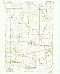
Other maps of this area

1901 · Fostoria
USGS Topo · 1:62,500

1901 · Bowling Green
USGS Topo · 1:62,500

1901 · Elmore
USGS Topo · 1:62,500

1903 · Bowling Green
USGS Topo · 1:62,500

1903 · Fostoria
USGS Topo · 1:62,500

1903 · Findlay
USGS Topo · 1:62,500

1903 · Elmore
USGS Topo · 1:62,500

1956 · Toledo
USGS Topo · 1:250,000

1958 · Jerry City
USGS Topo · 1:24,000

1958 · Bowling Green South
USGS Topo · 1:24,000