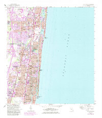
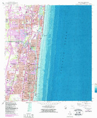
1962 Map of Boca Raton
USGS Topo · Published 1984About this map
Boca Raton and Deerfield Beach appear during a period of rapid coastal expansion along the Atlantic Ocean. The landscape is defined by the Intracoastal Waterway and various lagoons like Lake Wyman and Lake Boca Raton, which separate the mainland from burgeoning developments like Hillsboro Beach and Ocean Vue. This survey, updated with 1980s aerial data, highlights the transformation of older estates and open land into residential neighborhoods such as Floresta, Royal Oak Hills, and Lighthouse Point.
Find a feature on this map
83 named features on this map. Tap any name to fly to it.
Don’t see what you’re looking for? This feature index may not catch every label — zoom into the map to look around manually.
Map Details
Editions of this 1962 Boca Raton Map
5 editions found
Other maps of this area

1945 · Fort Lauderdale North
USGS Topo · 1:24,000

1946 · West Dixie Bend
USGS Topo · 1:24,000

1946 · Boca Raton
USGS Topo · 1:24,000

1947 · Delmar Farms
USGS Topo · 1:24,000

1949 · Fort Lauderdale North
USGS Topo · 1:24,000

1949 · West Dixie Bend
USGS Topo · 1:24,000

1949 · Pompano Beach
USGS Topo · 1:24,000

1949 · Delmar Farms
USGS Topo · 1:24,000

1950 · Boca Raton
USGS Topo · 1:24,000

1950 · Delray Beach
USGS Topo · 1:24,000