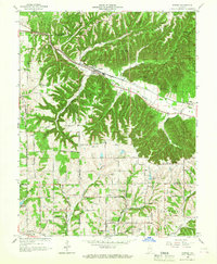
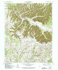
1966 Map of Borden
USGS Topo · Published 1979About this map
Borden sits at the convergence of the Muddy Fork valley and the Borden Br in southern Indiana, marking a landscape defined by the winding ridges and deep hollows of the Clark State Forest. The mid-1960s terrain shows a pattern of upland farmsteads and rural crossroads like Martinsburg, Scottsville, and Navilleton, connected by family-named roads such as Conway Road and Miller Evans Rd. The Monon railroad tracks follow the low ground along the fork, serving as the industrial spine for these valley communities. Genealogists and local historians can trace legacy landmarks including Pleasant Ridge Cem and Lear Hill Ch, alongside topographic curiosities like Cubby House Hill and the many named ravines such as Persimmon Hollow and Salt Well Hollow that drain the timbered heights of the knobs.
Find a feature on this map
70 named features on this map. Tap any name to fly to it.
Don’t see what you’re looking for? This feature index may not catch every label — zoom into the map to look around manually.
Map Details
Editions of this 1966 Borden Map
5 editions found
Other maps of this area

1938 · Speed
USGS Topo · 1:24,000

1939 · New Albany
USGS Topo · 1:24,000

1939 · Georgetown
USGS Topo · 1:24,000

1941 · Borden
USGS Topo · 1:24,000

1946 · New Albany
USGS Topo · 1:24,000

1947 · Speed
USGS Topo · 1:24,000

1947 · Georgetown
USGS Topo · 1:24,000

1949 · Henryville
USGS Topo · 1:24,000

1949 · Georgetown
USGS Topo · 1:24,000

1950 · Salem
USGS Topo · 1:24,000