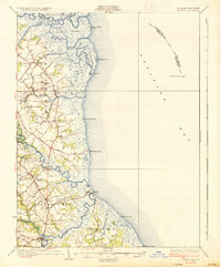
1936 Map of Bowers
USGS Topo · Published 1936About this map
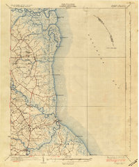
St Jones Neck and the surrounding marshlands of the Delaware Bay shoreline define this mid-1930s coastal survey. The landscape is a network of winding waterways like the Murderkill River and St Jones River that separate established inland towns from the exposed seasonal settlements at the water's edge. Communities such as Magnolia and Frederica serve as anchor points along Bay Road and U S Highway No 113, while smaller crossroads like Laffertys Corner and Postles Corner mark the rural interior. Cultural landmarks of deep local significance are documented throughout, including the venerable Barratts Chapel near the southern boundary and the Friends Meetinghouse to the north. Along the coast, isolated outposts like Kitts Hummock and Bennetts Pier provide rare access points to the bay, while the Mahon River L H and Elbow of Cross Ledge L H signal the maritime hazards of the era.
Find a feature on this map
62 named features on this map. Tap any name to fly to it.
Don’t see what you’re looking for? This feature index may not catch every label — zoom into the map to look around manually.
Map Details
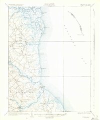
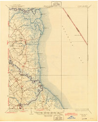
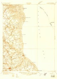
Editions of this 1936 Bowers Map
4 editions found