
1954 Map of Brownwood
USGS Topo · Published 1955About this map
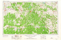
Lake Brownwood and the sprawling drainages of Pecan Bayou anchor this mid-century look at the Central Texas landscape. The region's transport network is dominated by the Gulf Colorado and Santa Fe RR, which connects established cattle and farming centers like Brownwood, Coleman, and Ballinger. The map reveals a transition from the rolling plains of Runnels and Coleman counties toward the more varied terrain of the Brady Mountains and the Pompey Mountains. Small agricultural settlements and rural post offices, such as Trickham, Priddy, and Zephyr, are scattered throughout the watershed of the Colorado River and Jim Ned Creek. Along the eastern edge, the terrain becomes increasingly dissected by the Leon River and Cowhouse Creek, illustrating the complex hydrology of the Edwards Plateau's northern fringe during a period of significant post-war infrastructure development.
Find a feature on this map
118 named features on this map. Tap any name to fly to it.
Don’t see what you’re looking for? This feature index may not catch every label — zoom into the map to look around manually.
Map Details
Editions of this 1954 Brownwood Map
3 editions found
Other maps of this area

1885 · San Saba
USGS Topo · 1:125,000

1887 · Llano
USGS Topo · 1:125,000

1887 · Lampasas
USGS Topo · 1:125,000

1887 · Mason
USGS Topo · 1:125,000

1887 · Burnet
USGS Topo · 1:125,000

1887 · Coleman
USGS Topo · 1:125,000

1888 · Hamilton
USGS Topo · 1:125,000

1888 · Meridian
USGS Topo · 1:125,000

1889 · Granbury
USGS Topo · 1:125,000

1889 · Brownwood
USGS Topo · 1:125,000