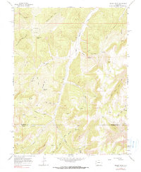
1964 Map of Brushy Point
USGS Topo · Published 1990About this map
Brushy Point and Ponderosa Point define the high terrain of this remote Colorado landscape, which was photogrammetrically mapped in the early 1960s. The area is characterized by a complex network of steep drainages, including East Douglas Creek and Wildhorse Canyon, carving through the high plateau. Human activity is largely represented by isolated outposts and a web of trails, most notably Trail Canyon Lodge and various Jeep Trails that navigate the ridges and canyon floors.
Find a feature on this map
31 named features on this map. Tap any name to fly to it.
Don’t see what you’re looking for? This feature index may not catch every label — zoom into the map to look around manually.
Map Details
Editions of this 1964 Brushy Point Map
4 editions found
Other maps of this area

1956 · Grand Junction
USGS Topo · 1:250,000

1959 · Grand Junction
USGS Topo · 1:250,000

1960 · Grand Junction
USGS Topo · 1:250,000

1962 · Grand Junction
USGS Topo · 1:250,000

1964 · Grand Junction
USGS Topo · 1:250,000

1964 · Douglas Pass
USGS Topo · 1:24,000

1964 · Brushy Point
USGS Topo · 1:24,000

1964 · Henderson Ridge
USGS Topo · 1:24,000

1964 · Black Cabin Gulch
USGS Topo · 1:24,000
1964 · White Coyote Draw
USGS Topo · 1:24,000