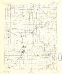
1894 Map of Burlingame
USGS Topo · Published 1913About this map
The Atchison Topeka and Santa Fe Railroad cuts a diagonal path through this late 19th-century Kansas landscape, anchoring a network of prairie settlements including Burlingame, Scranton, and Carbondale. This survey captures the region during a period of intense agrarian and rail expansion, where towns like Osage and Lyndon served as vital hubs for the surrounding townships. The intricate drainage systems of the Marais des Cygnes River and Wakarusa River define the terrain, revealing the natural hydrology that dictated early settlement patterns and agricultural development across Osage and Shawnee counties.
Find a feature on this map
92 named features on this map. Tap any name to fly to it.
Don’t see what you’re looking for? This feature index may not catch every label — zoom into the map to look around manually.
Map Details
Editions of this 1894 Burlingame Map
4 editions found


Other maps of this area

1885 · Eskridge
USGS Topo · 1:125,000

1885 · Burlington
USGS Topo · 1:125,000

1885 · Garnett
USGS Topo · 1:125,000

1885 · Lawrence
USGS Topo · 1:125,000

1886 · Oskaloosa
USGS Topo · 1:125,000

1888 · Emporia
USGS Topo · 1:125,000

1888 · Oskaloosa
USGS Topo · 1:125,000

1889 · Burlingame
USGS Topo · 1:125,000

1889 · Wamego
USGS Topo · 1:125,000

1889 · Eskridge
USGS Topo · 1:125,000