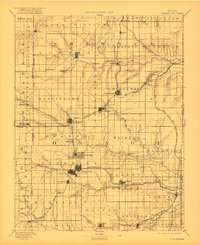
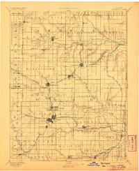
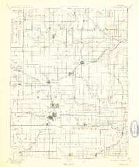
1894 Map of Burlingame
USGS Topo · Published 1922About this map
Burlingame and Osage City anchor this late 19th-century landscape, illustrating the rapid expansion of the eastern Kansas rail network. Several major lines, including the Atchison Topeka and Santa Fe Railroad and the Missouri Pacific Railroad, crisscross the county, dictating the placement of coal-rich settlements like Scranton and Peterton. The map captures a transition from traditional river-bound commerce toward industrial transit, as seen in the development along the Marais des Cygnes River and the numerous tributaries feeding the Wakarusa Creek.
Find a feature on this map
95 named features on this map. Tap any name to fly to it.
Don’t see what you’re looking for? This feature index may not catch every label — zoom into the map to look around manually.
Map Details
Editions of this 1894 Burlingame Map
4 editions found

Other maps of this area

1885 · Eskridge
USGS Topo · 1:125,000

1885 · Burlington
USGS Topo · 1:125,000

1885 · Garnett
USGS Topo · 1:125,000

1885 · Lawrence
USGS Topo · 1:125,000

1886 · Oskaloosa
USGS Topo · 1:125,000

1888 · Emporia
USGS Topo · 1:125,000

1888 · Oskaloosa
USGS Topo · 1:125,000

1889 · Burlingame
USGS Topo · 1:125,000

1889 · Wamego
USGS Topo · 1:125,000

1889 · Eskridge
USGS Topo · 1:125,000