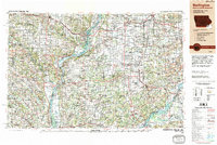
1990 Map of Burlington
USGS Topo · Published 1990About this map
The Mississippi River serves as the central artery of this tri-state region, where the borders of Iowa, Illinois, and Missouri converge. Large riverfront centers like Burlington, Fort Madison, and Keokuk anchor the western shore, while Nauvoo and Galesburg define the Illinois side. This late-twentieth-century landscape is shaped by heavy infrastructure, including the expansive Iowa Army Ammunition Plant and the intricate tracks of the Burlington Northern Railroad and the Atchison, Topeka and Santa Fe Railway.
Find a feature on this map
243 named features on this map. Tap any name to fly to it.
Don’t see what you’re looking for? This feature index may not catch every label — zoom into the map to look around manually.
Map Details
Editions of this 1990 Burlington Map
2 editions found

Other maps of this area

1903 · Kahoka
USGS Topo · 1:125,000

1903 · Palmyra
USGS Topo · 1:125,000

1903 · Edina
USGS Topo · 1:125,000

1909 · Tallula
USGS Topo · 1:62,500

1912 · Canton
USGS Topo · 1:62,500

1912 · Macomb
USGS Topo · 1:62,500

1913 · Colchester
USGS Topo · 1:62,500

1914 · Macomb
USGS Topo · 1:62,500

1915 · Avon
USGS Topo · 1:62,500

1916 · Good Hope
USGS Topo · 1:62,500