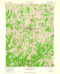
1960 Map of Cameron
USGS Topo · Published 1961About this map
Cameron serves as the central hub of this northern panhandle landscape, situated along the Baltimore and Ohio railroad corridor where it follows the course of Grave Creek. The town is well-established with civic infrastructure including the High School and the local Water Works. Moving away from the valley floor, the terrain is defined by a series of prominent ridges such as Fork Ridge and Cameron Ridge, where small rural settlements like Loudenville and Clouston are located.
Find a feature on this map
52 named features on this map. Tap any name to fly to it.
Don’t see what you’re looking for? This feature index may not catch every label — zoom into the map to look around manually.
Map Details
Editions of this 1960 Cameron Map
4 editions found
Other maps of this area

1903 · Littleton
USGS Topo · 1:62,500

1904 · Cameron
USGS Topo · 1:62,500

1905 · Mannington
USGS Topo · 1:62,500

1905 · Rogersville
USGS Topo · 1:62,500

1905 · Littleton
USGS Topo · 1:62,500

1923 · Mannington
USGS Topo · 1:62,500

1924 · Littleton
USGS Topo · 1:62,500

1926 · Littleton
USGS Topo · 1:62,500

1926 · Mannington
USGS Topo · 1:62,500

1935 · Cameron
USGS Topo · 1:62,500