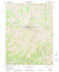
1960 Map of Cameron
USGS Topo · Published 1991About this map
Cameron sits as a central hub in this West Virginia landscape, where the Baltimore and Ohio railroad snakes through the valleys of Grave Creek and past the Welling Tunnel. The terrain is defined by a series of prominent ridges, including Fork Ridge and Spring Hill, which separate the various runs and creeks feeding into Fish Creek. Small settlements like Loudenville, Woodruff, and Bellton are scattered along these waterways and rail lines, reflecting a rural economy tied to both transportation and resource extraction, evidenced by the numerous Oil Wells and the Gas Field in the southern portion of the quadrangle.
Find a feature on this map
61 named features on this map. Tap any name to fly to it.
Don’t see what you’re looking for? This feature index may not catch every label — zoom into the map to look around manually.
Map Details
Editions of this 1960 Cameron Map
4 editions found
Other maps of this area

1903 · Littleton
USGS Topo · 1:62,500

1904 · Cameron
USGS Topo · 1:62,500

1905 · Mannington
USGS Topo · 1:62,500

1905 · Rogersville
USGS Topo · 1:62,500

1905 · Littleton
USGS Topo · 1:62,500

1923 · Mannington
USGS Topo · 1:62,500

1924 · Littleton
USGS Topo · 1:62,500

1926 · Littleton
USGS Topo · 1:62,500

1926 · Mannington
USGS Topo · 1:62,500

1935 · Cameron
USGS Topo · 1:62,500