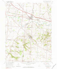
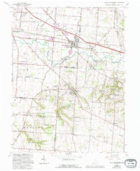
1966 Map of Canal Winchester
USGS Topo · Published 1983About this map
The village of Canal Winchester and the town of Lithopolis anchor this landscape during a period of transition in central Ohio. The infrastructure of the Chesapeake and Ohio Railroad runs parallel to the historic route of the Ohio Canal, showing how rail eclipsed water for transport along Walnut Creek. Cultural landmarks such as The Wagnalls Memorial in Lithopolis stand out alongside community institutions like the Township School and Salem Church.
Find a feature on this map
63 named features on this map. Tap any name to fly to it.
Don’t see what you’re looking for? This feature index may not catch every label — zoom into the map to look around manually.
Map Details
Editions of this 1966 Canal Winchester Map
5 editions found
Other maps of this area

1907 · Lancaster
USGS Topo · 1:62,500

1907 · Thurston
USGS Topo · 1:62,500

1909 · Lancaster
USGS Topo · 1:62,500

1909 · Thurston
USGS Topo · 1:62,500

1914 · Circleville
USGS Topo · 1:62,500

1925 · East Columbus
USGS Topo · 1:62,500

1943 · Circleville
USGS Topo · 1:62,500

1943 · East Columbus
USGS Topo · 1:62,500

1947 · Columbus
USGS Topo · 1:250,000
1955 · Lockbourne
USGS Topo · 1:24,000