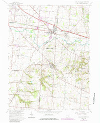
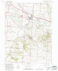
1966 Map of Canal Winchester
USGS Topo · Published 1985About this map
Canal Winchester serves as the focal point of this 1966 topographic survey, situated at the intersection of Fairfield and Franklin Counties during a period of transition toward suburban development. The landscape is defined by the winding course of Big Walnut Creek and the historical corridor of the Chesapeake and Ohio railroad. In the village of Lithopolis, the prominent The Wagnalls Memorial stands as a significant local landmark, while the southern reaches of the quadrangle include the protected lands of Slate Run Metropolitan Park. Smaller, older settlements like Greencastle and Marcy dot the rural areas, interspersed with local institutions such as Salem Ch and Township Sch. To the west, Groveport anchors the map near the Airway Beacon, illustrating the area's early aviation and transportation infrastructure. The terrain rises to the east at Chestnut Ridge, overlooking a network of family-named roads like Neiswander Road and Perrill Road.
Find a feature on this map
49 named features on this map. Tap any name to fly to it.
Don’t see what you’re looking for? This feature index may not catch every label — zoom into the map to look around manually.
Map Details
Editions of this 1966 Canal Winchester Map
5 editions found
Other maps of this area

1907 · Lancaster
USGS Topo · 1:62,500

1907 · Thurston
USGS Topo · 1:62,500

1909 · Lancaster
USGS Topo · 1:62,500

1909 · Thurston
USGS Topo · 1:62,500

1914 · Circleville
USGS Topo · 1:62,500

1925 · East Columbus
USGS Topo · 1:62,500

1943 · Circleville
USGS Topo · 1:62,500

1943 · East Columbus
USGS Topo · 1:62,500

1947 · Columbus
USGS Topo · 1:250,000
1955 · Lockbourne
USGS Topo · 1:24,000