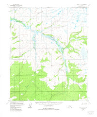
1954 Map of Candle C-2
USGS Topo · Published 1981About this map
The South Fork Buckland River and its meandering tributaries dominate this mid-century survey of the Alaskan interior. This uninhabited landscape is defined by the complex hydrology of the Kalusuk Creek and Little Kalusuk Creek drainages, which carve through the terrain before joining the larger river system. The presence of Middle Fork Buckland River in the northwest corner highlights the confluence of major seasonal waterways. At this time, the area remained largely unsurveyed on the ground, with topographical data derived primarily from aerial photography. The map provides a detailed look at the drainage patterns and elevations near South Fork and Garnet, offering a rare view of this remote territory before modern navigational changes. It serves as a foundational record of the natural geography of the Kateel River Meridian region.
Find a feature on this map
6 named features on this map. Tap any name to fly to it.
Don’t see what you’re looking for? This feature index may not catch every label — zoom into the map to look around manually.
Map Details
Editions of this 1954 Candle C-2 Map
3 editions found
Other maps of this area

1951 · Candle
USGS Topo · 1:250,000

1954 · Candle C-2
USGS Topo · 1:63,360

1954 · Candle B-2
USGS Topo · 1:63,360
1954 · Candle D-1
USGS Topo · 1:63,360

1954 · Candle C-1
USGS Topo · 1:63,360

1954 · Candle D-2
USGS Topo · 1:63,360

1954 · Candle B-1
USGS Topo · 1:63,360

1955 · Candle
USGS Topo · 1:250,000

1955 · Candle B-3
USGS Topo · 1:63,360

1955 · Candle C-3
USGS Topo · 1:63,360