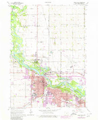
1963 Map of Cedar Falls
USGS Topo · Published 1980About this map
The Cedar River and West Fork Cedar River dominate this landscape, where the urban expansion of Cedar Falls and Waterloo meets the surrounding agricultural townships of Washington and Mount Vernon. The map captures the significant presence of the Univ of Northern Iowa and a dense network of educational institutions like Laboratory High Sch and Cedar Falls High Sch. Settlement patterns follow the riverbanks and the heavy rail corridors of the Chicago Rock Island and Pacific and Illinois Central railroads. The 1970s updates, shown in purple, illustrate the suburban growth pushing into formerly rural areas near Cedar Valley Memorial Gardens (Cemetery) and along Rainbow Dr. Recreational and conservation spaces are prominent, notably the extensive George Wyth Memorial State Park and Island Park, which buffer the industrial and residential development of the twin cities.
Find a feature on this map
78 named features on this map. Tap any name to fly to it.
Don’t see what you’re looking for? This feature index may not catch every label — zoom into the map to look around manually.
Map Details
Editions of this 1963 Cedar Falls Map
4 editions found
Other maps of this area

1954 · Waterloo
USGS Topo · 1:250,000

1955 · Waterloo
USGS Topo · 1:250,000

1963 · Waverly
USGS Topo · 1:24,000

1963 · Denver
USGS Topo · 1:24,000

1963 · Hudson
USGS Topo · 1:24,000

1963 · Waterloo South
USGS Topo · 1:24,000

1963 · Cedar Falls
USGS Topo · 1:24,000

1963 · Waterloo North
USGS Topo · 1:24,000

1971 · Zaneta
USGS Topo · 1:24,000

1971 · Shell Rock
USGS Topo · 1:24,000