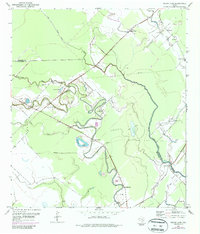
1952 Map of Cedar Lane
USGS Topo · Published 1987About this map
Caney Creek carves a serpentine path through the coastal lowlands of the Brazoria and Matagorda county line, anchoring a landscape of marshes and oxbow lakes. Small rural communities like Cedar Lane and Hawkinsville are central to this 1952 topographic study, which was updated with 1972 aerial photography to show evolving infrastructure. The map reveals a high concentration of institutional landmarks for such a sparsely populated area, including Magnolia Sch, Kennedy Sch, and several houses of worship such as St Mark Ch and Grace Ch.
Find a feature on this map
26 named features on this map. Tap any name to fly to it.
Don’t see what you’re looking for? This feature index may not catch every label — zoom into the map to look around manually.
Map Details
Editions of this 1952 Cedar Lane Map
4 editions found
Other maps of this area

1950 · Houston
USGS Topo · 1:250,000

1951 · Bay City
USGS Topo · 1:250,000

1952 · Sweeny
USGS Topo · 1:24,000

1952 · Ashwood
USGS Topo · 1:24,000

1952 · Lake Austin
USGS Topo · 1:24,000

1952 · Cedar Lane NE
USGS Topo · 1:24,000

1952 · Cedar Lakes West
USGS Topo · 1:24,000

1952 · Bay City NE
USGS Topo · 1:24,000

1952 · Brazoria
USGS Topo · 1:24,000

1952 · Cedar Lane
USGS Topo · 1:24,000