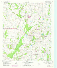
1962 Map of Cedarvale
USGS Topo · Published 1982About this map
Muddy Cedar Creek and Allen Creek wind through the borderlands between Kaufman Co and Van Zandt Co, defining a rural landscape shaped by small communities and oil exploration. Centered on the settlement of Cedarvale, the topography reveals a pattern of dispersed country churches and burial grounds essential for family history research, including the North Bouie Ch, South Bouie Ch, and the Heidle Cem. The local economy is visibly anchored by the Fair Oil Field and scattered agricultural clearings among the creek branches.
Find a feature on this map
23 named features on this map. Tap any name to fly to it.
Don’t see what you’re looking for? This feature index may not catch every label — zoom into the map to look around manually.
Map Details
Editions of this 1962 Cedarvale Map
2 editions found

Other maps of this area

1920 · Kemp
USGS Topo · 1:62,500

1948 · Martins Mill
USGS Topo · 1:62,500

1949 · Martins Mill
USGS Topo · 1:62,500

1954 · Dallas
USGS Topo · 1:250,000

1956 · Tyler
USGS Topo · 1:250,000

1957 · Kemp
USGS Topo · 1:62,500

1958 · Dallas
USGS Topo · 1:250,000

1961 · Kemp
USGS Topo · 1:24,000

1962 · Myrtle Springs
USGS Topo · 1:24,000

1962 · Prairieville
USGS Topo · 1:24,000