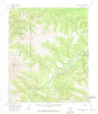
1956 Map of Charley River A-5
USGS Topo · Published 1971About this map
The Charley River meanders through a network of high ridges and deep drainages in this mid-century survey of the Alaska interior. The landscape is defined by its complex hydrology, where northern-flowing tributaries like Coal Creek and Sam Creek carve through the elevation. Landmarks like Twin Mountain and the survey station at VABM 3429 Fish provide fixed points of reference in a territory devoid of roads or settlements at the time of the 1956 field annotation. The drainage patterns of Highland Creek and Hanna Creek suggest a terrain where water movement is the primary architect of the land. This map captures the region in a purely natural state, documented through aerial photography taken in the early 1950s, before significant modern changes. It serves as a precise record of wilderness topography and unnamed ridges that characterize this portion of the Yukon-Koyukuk region.
Find a feature on this map
17 named features on this map. Tap any name to fly to it.
Don’t see what you’re looking for? This feature index may not catch every label — zoom into the map to look around manually.
Map Details
Editions of this 1956 Charley River A-5 Map
2 editions found
Other maps of this area

1951 · Charley River
USGS Topo · 1:250,000

1951 · Eagle
USGS Topo · 1:250,000

1956 · Charley River B-6
USGS Topo · 1:63,360

1956 · Charley River A-5
USGS Topo · 1:63,360

1956 · Charley River A-4
USGS Topo · 1:63,360

1956 · Charley River B-5
USGS Topo · 1:63,360

1956 · Charley River A-6
USGS Topo · 1:63,360

1956 · Charley River B-4
USGS Topo · 1:63,360

1956 · Charley River
USGS Topo · 1:250,000
1956 · Eagle D-5
USGS Topo · 1:63,360