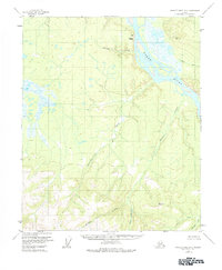
1956 Map of Charley River B-6
USGS Topo · Published 1984About this map
The Yukon River cuts a prominent path through this Alaskan interior landscape, flanked by the elevated Takoma Bluff. This 1956 field-annotated survey reveals a wilderness defined by its complex drainage network, where numerous waterways like Takoma Creek and Eureka Creek flow toward the primary river channel. The absence of roads or established trails on the sheet emphasizes the remote nature of the terrain during the mid-twentieth century.
Find a feature on this map
9 named features on this map. Tap any name to fly to it.
Don’t see what you’re looking for? This feature index may not catch every label — zoom into the map to look around manually.
Map Details
Editions of this 1956 Charley River B-6 Map
3 editions found
Other maps of this area

1951 · Charley River
USGS Topo · 1:250,000

1951 · Circle
USGS Topo · 1:250,000

1955 · Circle A-1
USGS Topo · 1:63,360

1955 · Circle B-1
USGS Topo · 1:63,360

1955 · Circle C-1
USGS Topo · 1:63,360

1955 · Circle
USGS Topo · 1:250,000

1956 · Charley River C-5
USGS Topo · 1:63,360

1956 · Charley River C-6
USGS Topo · 1:63,360

1956 · Charley River B-6
USGS Topo · 1:63,360

1956 · Charley River A-5
USGS Topo · 1:63,360