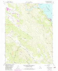
1958 Map of Chiles Valley
USGS Topo · Published 1984About this map
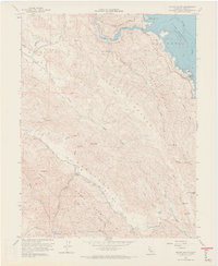
Chiles Valley and Catacula Valley form the heart of this Napa County landscape, where the ridges of Cedar Roughs and Trout Creek Ridge define the steep topography. Grounded in mid-century land use, the map documents the transition of the regional water system, most notably the presence of Lake Berryessa at the northeastern corner. Historical industry and settlement are represented by the Chiles Grist Mill along the Pope Valley Road and the established resort sites at Samuel Springs and Rancho Monticello. These features reflect a period before modern development, when rural commerce revolved around small springs and local milling. The survey also details the complex drainage networks of Maxwell Creek and Putah Creek Park, providing a clear view of the canyon-and-valley structure that has long dictated movement through these coastal ranges.
Find a feature on this map
46 named features on this map. Tap any name to fly to it.
Don’t see what you’re looking for? This feature index may not catch every label — zoom into the map to look around manually.
Map Details
Editions of this 1958 Chiles Valley Map
8 editions found
Other maps of this area

1902 · Napa
USGS Topo · 1:125,000

1921 · Mt. Vaca
USGS Topo · 1:62,500

1924 · Capay
USGS Topo · 1:62,500

1942 · Sonoma
USGS Topo · 1:62,500

1942 · Mt. Vaca
USGS Topo · 1:62,500

1942 · St. Helena
USGS Topo · 1:62,500

1943 · Capay
USGS Topo · 1:62,500

1945 · Capay
USGS Topo · 1:62,500

1945 · St. Helena
USGS Topo · 1:62,500

1947 · Santa Rosa
USGS Topo · 1:250,000