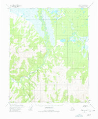
1955 Map of Circle B-1
USGS Topo · Published 1977About this map
Birch Creek winds through this interior Alaskan wilderness, as mapped from aerial photography in the early 1950s. The landscape is defined by the complex drainage of the South Fork Big Windy Cr and the waters of Medicine Lake in the northwest. This survey, compiled from 1951–1954 photography, captures a region largely devoid of permanent infrastructure, with land lines representing unsurveyed and unmarked locations predetermined by the Bureau of Land Management. Isolated Cabins and a lone Cabin along the creek banks suggest the presence of seasonal trappers or miners. Strategic high points are marked by triangulation stations such as VABM Beauty 2501 and VABM Poul 919, providing the essential survey control for this remote quadrangle during the mid-century mapping of the Alaska interior.
Find a feature on this map
8 named features on this map. Tap any name to fly to it.
Don’t see what you’re looking for? This feature index may not catch every label — zoom into the map to look around manually.
Map Details
Editions of this 1955 Circle B-1 Map
4 editions found
Other maps of this area

1951 · Charley River
USGS Topo · 1:250,000

1951 · Circle
USGS Topo · 1:250,000

1955 · Circle A-2
USGS Topo · 1:63,360

1955 · Circle A-1
USGS Topo · 1:63,360

1955 · Circle B-1
USGS Topo · 1:63,360

1955 · Circle C-2
USGS Topo · 1:63,360

1955 · Circle B-2
USGS Topo · 1:63,360

1955 · Circle C-1
USGS Topo · 1:63,360

1955 · Circle
USGS Topo · 1:250,000

1956 · Charley River C-6
USGS Topo · 1:63,360