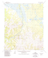
1955 Map of Circle B-1
USGS Topo · Published 1988About this map
Birch Creek meanders through the central portion of this 1950s survey, marking a distinct boundary between the wetland flats to the north and the rising elevations of the Steese National Conservation Area. The terrain reflects a landscape defined by water and altitude, with Medicine Lake anchoring the northwestern corner amid a network of smaller ponds and marshland. The southern half of the sheet transitions into more varied relief, where drainage systems like the South Fork and Big Windy Cr cut through the hills. Isolated Cabins appear along the banks of the primary creek, indicating the sparse human presence and the importance of river access in this portion of the Alaska interior. The inclusion of several survey points, such as VABM 2501 Beauty and VABM 919 Paul, provides exact elevation references for the ridge lines overlooking the central valley.
Find a feature on this map
10 named features on this map. Tap any name to fly to it.
Don’t see what you’re looking for? This feature index may not catch every label — zoom into the map to look around manually.
Map Details
Editions of this 1955 Circle B-1 Map
4 editions found
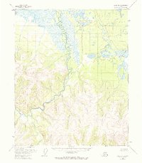
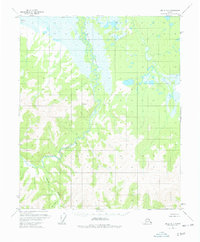
Other maps of this area

1951 · Charley River
USGS Topo · 1:250,000

1951 · Circle
USGS Topo · 1:250,000

1955 · Circle A-2
USGS Topo · 1:63,360

1955 · Circle A-1
USGS Topo · 1:63,360

1955 · Circle B-1
USGS Topo · 1:63,360

1955 · Circle C-2
USGS Topo · 1:63,360

1955 · Circle B-2
USGS Topo · 1:63,360

1955 · Circle C-1
USGS Topo · 1:63,360

1955 · Circle
USGS Topo · 1:250,000

1956 · Charley River C-6
USGS Topo · 1:63,360