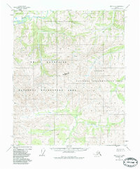
1951 Map of Circle C-6
USGS Topo · Published 1986About this map
White Mountains dominate this high-latitude terrain, where the peaks of Rocky Mountain rise above a landscape defined by drainage networks and seasonal wetlands. Surveyed in the early 1950s, the map reveals an interior Alaskan wilderness largely devoid of permanent settlements, save for a lone Cabin situated along a tributary of Quartz Creek. The region is structured by the winding course of Beaver Creek and its many feeders, including Warren Creek and Mascot Creek. This era of mapping was conducted before the formalization of modern protected boundaries, though later designations like the Steese National Conservation Area and White Mountains National Recreation Area now define the land use. The topography reflects the complex drainage patterns of the Bear Creek and Yellow Creek watersheds, capturing the territory as it existed prior to the development of modern access routes.
Find a feature on this map
13 named features on this map. Tap any name to fly to it.
Don’t see what you’re looking for? This feature index may not catch every label — zoom into the map to look around manually.
Map Details
Editions of this 1951 Circle C-6 Map
3 editions found
Other maps of this area

1945 · Livengood
USGS Topo · 1:250,000

1951 · Livengood
USGS Topo · 1:250,000

1951 · Circle
USGS Topo · 1:250,000

1951 · Circle D-6
USGS Topo · 1:63,360

1951 · Livengood C-1
USGS Topo · 1:63,360

1951 · Circle C-6
USGS Topo · 1:63,360

1952 · Livengood D-1
USGS Topo · 1:63,360

1952 · Circle D-5
USGS Topo · 1:63,360

1952 · Circle C-5
USGS Topo · 1:63,360

1954 · Circle C-5
USGS Topo · 1:63,360