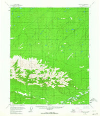
1952 Map of Circle D-4
USGS Topo · Published 1963About this map
The White Mountains dominate the southern half of this landscape, rising above a network of drainages that define the sub-arctic terrain. In the early 1950s, when these aerial photographs were captured, the region remained an unroaded wilderness focused on the complex hydrology of the Preacher Creek system. The map records the meandering path of the North Fork Preacher Creek as it winds through the foothills, eventually joining the main stem in the southeast. Further north, the isolated flow of Discovery Creek cuts through the high plateaus, illustrating the raw, unsurveyed character of the Alaskan interior during this mid-century period of federal land management by the Bureau of Land Management.
Find a feature on this map
4 named features on this map. Tap any name to fly to it.
Don’t see what you’re looking for? This feature index may not catch every label — zoom into the map to look around manually.
Map Details
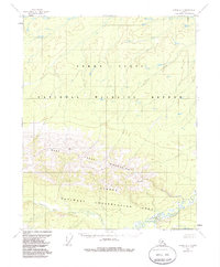
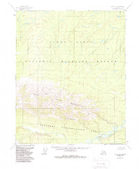
Editions of this 1952 Circle D-4 Map
4 editions found
Other maps of this area

1951 · Fort Yukon
USGS Topo · 1:250,000

1951 · Circle
USGS Topo · 1:250,000

1952 · Circle D-4
USGS Topo · 1:63,360

1952 · Circle D-3
USGS Topo · 1:63,360

1952 · Circle C-4
USGS Topo · 1:63,360

1952 · Circle D-5
USGS Topo · 1:63,360

1952 · Circle C-5
USGS Topo · 1:63,360

1954 · Circle C-5
USGS Topo · 1:63,360

1954 · Circle D-5
USGS Topo · 1:63,360

1955 · Circle C-3
USGS Topo · 1:63,360