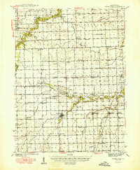
1949 Map of Cissna Park
USGS Topo · Published 1949About this map
Cissna Park sits at the heart of this Iroquois County landscape, where the agricultural grid of East Central Illinois is punctuated by an extensive network of one-room schoolhouses and rural churches. The area is defined by the winding course of Pigeon Creek and Mud Creek, which break the geometric precision of the township lines. The settlement pattern of the late 1940s reveals a deeply local infrastructure, with dozens of named schools such as Possum Trot Sch and Pond Lily Sch serving the surrounding farmsteads.
Find a feature on this map
63 named features on this map. Tap any name to fly to it.
Don’t see what you’re looking for? This feature index may not catch every label — zoom into the map to look around manually.
Map Details
Editions of this 1949 Cissna Park Map
3 editions found

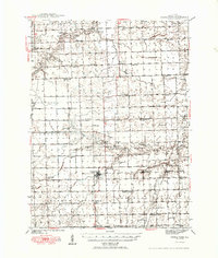
Other maps of this area

1924 · Paxton
USGS Topo · 1:62,500

1927 · Paxton
USGS Topo · 1:62,500

1933 · Hoopeston
USGS Topo · 1:48,000

1935 · Watseka
USGS Topo · 1:48,000

1936 · Potomac
USGS Topo · 1:62,500

1938 · Milford
USGS Topo · 1:48,000

1938 · Hoopeston
USGS Topo · 1:62,500

1939 · Watseka
USGS Topo · 1:62,500

1939 · Cissna Park
USGS Topo · 1:62,500

1944 · Milford
USGS Topo · 1:62,500