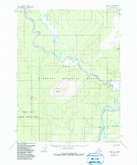
1956 Map of Coleen A-4
USGS Topo · Published 1985About this map
The confluence of the Coleen River and the Porcupine River dominates this interior Alaskan landscape. Mapped from 1955 aerial photography with field annotations from 1956, the terrain is defined by prominent elevations like Coleen Mountain and Mount Marr. The area represents a point of geographic transition, where the northern reaches of the Yukon Flats National Wildlife Refuge meet the Arctic National Wildlife Refuge. A solitary Winter Trail in the northwest and the named location at Burnt Paw along the Porcupine River indicate the sparse but established routes used for travel through these remote river corridors. The survey provides a clear look at the braided river systems and topographical contours of the Brooks Range foothills before the establishment of modern conservation boundaries under later federal acts.
Find a feature on this map
8 named features on this map. Tap any name to fly to it.
Don’t see what you’re looking for? This feature index may not catch every label — zoom into the map to look around manually.
Map Details
Editions of this 1956 Coleen A-4 Map
4 editions found
Other maps of this area

1951 · Black River
USGS Topo · 1:250,000

1951 · Coleen
USGS Topo · 1:250,000

1956 · Coleen
USGS Topo · 1:250,000

1956 · Black River D-3
USGS Topo · 1:63,360

1956 · Coleen A-5
USGS Topo · 1:63,360

1956 · Black River D-4
USGS Topo · 1:63,360

1956 · Black River D-5
USGS Topo · 1:63,360

1956 · Coleen A-3
USGS Topo · 1:63,360

1956 · Coleen A-4
USGS Topo · 1:63,360

1956 · Black River
USGS Topo · 1:250,000