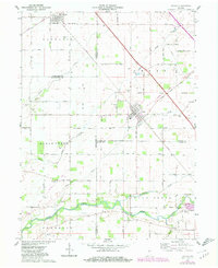
1962 Map of Colfax
USGS Topo · Published 1980About this map
Clarks Hill and Colfax serve as the primary hubs in this agricultural landscape where the borders of Tippecanoe, Clinton, Montgomery, and Boone counties converge. The geography is defined by a series of watercourses including Sugar Creek, Potato Creek, and Withe Creek, which have shaped the local drainage patterns and placement of rural cemeteries. A notable diagonal line across the terrain is the Indian Treaty Boundary, which cuts through the township grids and reflects the early 19th-century surveying of the region. The map reveals a high density of local history markers, from the Plainview Ch to several small family and community burial grounds such as Loveless Cem and Mc Kendra Cem. Transportation infrastructure is dominated by the Conrail and Norfolk And Western rail lines, which intersect at Colfax, illustrating the town's historical importance as a railway junction.
Find a feature on this map
33 named features on this map. Tap any name to fly to it.
Don’t see what you’re looking for? This feature index may not catch every label — zoom into the map to look around manually.
Map Details
Editions of this 1962 Colfax Map
2 editions found
Other maps of this area

1953 · Danville
USGS Topo · 1:250,000

1955 · Danville
USGS Topo · 1:250,000

1956 · Danville
USGS Topo · 1:250,000

1958 · Darlington
USGS Topo · 1:24,000

1958 · Kirkpatrick
USGS Topo · 1:24,000

1961 · Mulberry
USGS Topo · 1:24,000

1961 · Stockwell
USGS Topo · 1:24,000

1961 · Frankfort
USGS Topo · 1:24,000
1961 · Hazelrigg
USGS Topo · 1:24,000
1961 · Shannondale
USGS Topo · 1:24,000