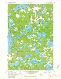
1960 Map of Cross Lake
USGS Topo · Published 1981About this map
The Cross Lake chain of lakes dominates this landscape in the late 1950s, revealing a region defined by its complex interconnected waterways and emerging post-war recreation. The map highlights the distinct village boundaries of Fifty Lakes and Cross Lake, which were evolving from seasonal outposts into more established communities. Civic life is anchored by local landmarks like the Cross Lake Sch and the Pinewood Cem, while the Cross Lake PO and Fifty Lakes PO mark the centers of mail and commerce for the area's residents.
Find a feature on this map
63 named features on this map. Tap any name to fly to it.
Don’t see what you’re looking for? This feature index may not catch every label — zoom into the map to look around manually.
Map Details
Editions of this 1960 Cross Lake Map
4 editions found

Other maps of this area

1913 · Cuyuna
USGS Topo · 1:62,500

1915 · Cuyuna
USGS Topo · 1:62,500

1953 · Duluth
USGS Topo · 1:250,000

1953 · Brainerd
USGS Topo · 1:250,000

1957 · Brainerd
USGS Topo · 1:250,000

1958 · Brainerd
USGS Topo · 1:250,000

1958 · Duluth
USGS Topo · 1:250,000

1959 · Trommald
USGS Topo · 1:24,000

1959 · Pelican Lake
USGS Topo · 1:24,000

1959 · Lower Whitefish Lake
USGS Topo · 1:24,000