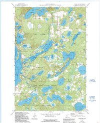
1960 Map of Cross Lake
USGS Topo · Published 1995About this map
Cross Lake and Fifty Lakes center this landscape of the Brainerd Lakes region, showing the intricate hydrology of the Pine River watershed. The map details the transition from early lakeside settlements to growing resort communities, where Manhattan Beach and Emily define the northern and eastern reaches. A heavy presence of public land is established by the Crow Wing State Forest, which blankets the southern portion of the sheet. Genealogical and local history value is found in small-scale landmarks such as the Cross Lake Sch and the Pinewood Cem near the banks of the Pine River. The presence of the Gaging Station and various Gravel Pit sites indicates the active management of the area's natural resources. From The Narrows at East Fox Lake to the complex shoreline of Little Pine Lake, the map documents the late 20th-century development of this central Minnesota lake country.
Find a feature on this map
66 named features on this map. Tap any name to fly to it.
Don’t see what you’re looking for? This feature index may not catch every label — zoom into the map to look around manually.
Map Details
Editions of this 1960 Cross Lake Map
4 editions found

Other maps of this area

1913 · Cuyuna
USGS Topo · 1:62,500

1915 · Cuyuna
USGS Topo · 1:62,500

1953 · Duluth
USGS Topo · 1:250,000

1953 · Brainerd
USGS Topo · 1:250,000

1957 · Brainerd
USGS Topo · 1:250,000

1958 · Brainerd
USGS Topo · 1:250,000

1958 · Duluth
USGS Topo · 1:250,000

1959 · Trommald
USGS Topo · 1:24,000

1959 · Pelican Lake
USGS Topo · 1:24,000

1959 · Lower Whitefish Lake
USGS Topo · 1:24,000