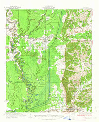
1935 Map of Crowder
USGS Topo · Published 1935About this map
Tallahatchie River and Coldwater River dominate this 1930s landscape, winding through a complex network of bayous and oxbow lakes such as Twin Lakes and Patterson Lakes. The topography reflects a region shaped by water management and early twentieth-century infrastructure, featuring an Abandoned R R running north of Crowder. This survey is notable for its depiction of the Chickasaw Boundary Line, which cuts across the eastern hills near Sherman Hill. The delta lowlands contrast sharply with the rising ground to the east, where small communities like Teasdale and Bellamy are established. Local social centers are well-documented, including the Quitman Co Hunting Club and numerous educational landmarks like Rosewald Sch and Canal White Sch. The town of Charleston serves as a primary hub in the south, while smaller settlements and churches like Oak Grove Ch and Allen Chapel dot the alluvial plain.
Find a feature on this map
93 named features on this map. Tap any name to fly to it.
Don’t see what you’re looking for? This feature index may not catch every label — zoom into the map to look around manually.
Map Details
Editions of this 1935 Crowder Map
3 editions found
Other maps of this area

1931 · Sumner
USGS Topo · 1:48,000

1932 · Sledge
USGS Topo · 1:48,000

1932 · Philipp
USGS Topo · 1:48,000

1932 · Tutwiler
USGS Topo · 1:48,000

1932 · Marks
USGS Topo · 1:48,000

1935 · Crowder
USGS Topo · 1:62,500

1935 · Marks
USGS Topo · 1:62,500

1935 · Sumner
USGS Topo · 1:62,500

1935 · Tutwiler
USGS Topo · 1:62,500

1935 · Sledge
USGS Topo · 1:62,500