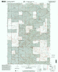
1997 Map of Deep Creek South
USGS Topo · Published 2001About this map
The Little Missouri National Grassland dominates this landscape in Slope County, where the topography is defined by the drainages of Deep Creek and Sand Creek. The map documents a sparsely populated ranching region during the late 1990s, characterized by isolated holdings such as the HT Ranch, Fischer Ranch, and other unnamed ranch sites. The terrain is notably marked by Round Top Butte, a prominent landmark amidst a network of 4wd tracks that serve as the primary means of navigating the backcountry. Civil divisions including Richland Center and Harper Slope Center are recorded, though these labels represent township-level survey units rather than concentrated towns. This survey reflects the persistence of large-scale cattle ranching and public land management, with small-scale industrial activity present at a Gravel Pit near the northern boundary.
Find a feature on this map
14 named features on this map. Tap any name to fly to it.
Don’t see what you’re looking for? This feature index may not catch every label — zoom into the map to look around manually.
Map Details
Editions of this 1997 Deep Creek South Map
This is the sole edition of this map. No revisions or reprints were ever made.
Other maps of this area

1953 · Dickinson
USGS Topo · 1:250,000

1957 · Dickinson
USGS Topo · 1:250,000

1961 · Rocky Ridge
USGS Topo · 1:62,500

1973 · Black Butte
USGS Topo · 1:24,000

1973 · Stewart Lake
USGS Topo · 1:24,000

1979 · Deep Creek North
USGS Topo · 1:24,000

1979 · Ives
USGS Topo · 1:24,000

1980 · Spring Creek
USGS Topo · 1:24,000

1980 · Belfield
USGS Topo · 1:100,000

1981 · Bowman
USGS Topo · 1:100,000