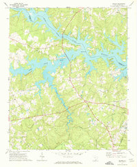
1970 Map of Delmar
USGS Topo · Published 1973About this map
The Saluda River Lake Murray reservoir dominates this 1970 landscape, its irregular shoreline creating a complex network of inlets and coves where the Little Saluda River and Bush River converge. The topography reveals a transition from these flooded valleys to the upland ridges of rural Saluda and Newberry Counties. The settlement of Delmar serves as a central point in the southern half of the map, surrounded by a high density of rural religious centers that anchored the community's social fabric. Notable landmarks include St Marks Ch, Nazareth Ch, and Bethel No 1 Ch, while the presence of the Utopia Sch provides a record of local educational history in the region. Numerous creeks like Clouds Creek and Rocky Creek thread through the terrain, illustrating the original drainage patterns before the full development of the reservoir system.
Find a feature on this map
23 named features on this map. Tap any name to fly to it.
Don’t see what you’re looking for? This feature index may not catch every label — zoom into the map to look around manually.
Map Details
Editions of this 1970 Delmar Map
This is the sole edition of this map. No revisions or reprints were ever made.
Other maps of this area

1904 · Columbia
USGS Topo · 1:125,000

1941 · Spartanburg
USGS Topo · 1:250,000

1944 · Gilbert
USGS Topo · 1:62,500

1953 · Spartanburg
USGS Topo · 1:250,000

1954 · Augusta
USGS Topo · 1:250,000

1957 · Augusta
USGS Topo · 1:250,000

1958 · Augusta
USGS Topo · 1:250,000

1960 · Spartanburg
USGS Topo · 1:250,000

1961 · Augusta
USGS Topo · 1:250,000

1962 · Augusta
USGS Topo · 1:250,000