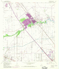
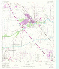
1955 Map of Dickinson
USGS Topo · Published 1970About this map
Dickinson Bayou meanders through this coastal landscape, serving as a primary geographical anchor for the growing residential and industrial sectors of Galveston County. During the mid-1950s, the region saw a significant expansion of the petroleum industry, evidenced by the League City Oil Field and the complex network of pipelines and storage tanks concentrated near Dickinson. The map reveals the early footprint of modern infrastructure, with the Gulf Freeway cutting a diagonal path through the terrain, paralleling the older Galveston Houston and Henderson rail line.
Find a feature on this map
20 named features on this map. Tap any name to fly to it.
Don’t see what you’re looking for? This feature index may not catch every label — zoom into the map to look around manually.
Map Details
Editions of this 1955 Dickinson Map
5 editions found
Other maps of this area

1916 · Genoa
USGS Topo · 1:24,000

1916 · Seabrook
USGS Topo · 1:24,000

1920 · Seabrook
USGS Topo · 1:31,680

1920 · Genoa
USGS Topo · 1:31,680

1929 · Dickinson
USGS Topo · 1:24,000

1929 · Algoa
USGS Topo · 1:24,000

1929 · Hitchcock
USGS Topo · 1:24,000

1929 · Virginia Point
USGS Topo · 1:24,000

1929 · Texas City
USGS Topo · 1:24,000

1932 · Algoa
USGS Topo · 1:31,680