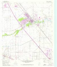
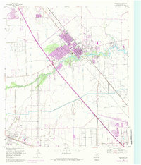
1955 Map of Dickinson
USGS Topo · Published 1977About this map
Dickinson emerges as a central hub on the Texas Gulf Coast, defined by the winding course of Dickinson Bayou and the intersection of vital transport lines. To the south, the expansive grounds of Camp Wallace reflect the area’s wartime history, while the southern margin traces the Atchison Topeka and Santa Fe railroad through Arcadia. The landscape shows a mix of recreational and industrial development, from the Dickinson Country Club to the League City Oil Field and numerous pipeline networks.
Find a feature on this map
27 named features on this map. Tap any name to fly to it.
Don’t see what you’re looking for? This feature index may not catch every label — zoom into the map to look around manually.
Map Details
Editions of this 1955 Dickinson Map
5 editions found
Other maps of this area

1916 · Genoa
USGS Topo · 1:24,000

1916 · Seabrook
USGS Topo · 1:24,000

1920 · Seabrook
USGS Topo · 1:31,680

1920 · Genoa
USGS Topo · 1:31,680

1929 · Dickinson
USGS Topo · 1:24,000

1929 · Algoa
USGS Topo · 1:24,000

1929 · Hitchcock
USGS Topo · 1:24,000

1929 · Virginia Point
USGS Topo · 1:24,000

1929 · Texas City
USGS Topo · 1:24,000

1932 · Algoa
USGS Topo · 1:31,680