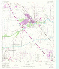
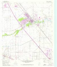
1955 Map of Dickinson
USGS Topo · Published 1984About this map
Dickinson emerges as a developing coastal prairie hub in this mid-century survey, revised with mid-1970s urban data shown in purple. The landscape is a complex network of industrial and agricultural infrastructure, featuring the League City Oil Field and numerous pipelines and siphons. Heavy transport corridors including the Gulf Freeway and the Atchison Topeka and Santa Fe railroad bisect the terrain, connecting the area to the Houston and Galveston hinterlands.
Find a feature on this map
25 named features on this map. Tap any name to fly to it.
Don’t see what you’re looking for? This feature index may not catch every label — zoom into the map to look around manually.
Map Details
Editions of this 1955 Dickinson Map
5 editions found
Other maps of this area

1916 · Genoa
USGS Topo · 1:24,000

1916 · Seabrook
USGS Topo · 1:24,000

1920 · Seabrook
USGS Topo · 1:31,680

1920 · Genoa
USGS Topo · 1:31,680

1929 · Dickinson
USGS Topo · 1:24,000

1929 · Algoa
USGS Topo · 1:24,000

1929 · Hitchcock
USGS Topo · 1:24,000

1929 · Virginia Point
USGS Topo · 1:24,000

1929 · Texas City
USGS Topo · 1:24,000

1932 · Algoa
USGS Topo · 1:31,680