
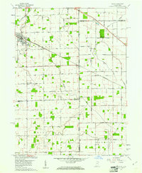
1960 Map of Dixon
USGS Topo · Published 1961About this map
Monroeville anchors the northwestern corner of this landscape, situated along the Conrail line and the winding path of Flatrock Creek. The map documents a predominantly agricultural borderland where Indiana and Ohio meet, characterized by a dense grid of township roads and several small communities like Dixon, East Liberty, and Wolfcale. The survey illustrates the rural infrastructure of the mid-twentieth century, noting numerous country cemeteries such as Odd Fellows Cem and Alpha Cem, alongside foundational local institutions including Walnut Grove Ch and Bethlehem Ch. The drainage patterns are defined by a network of engineered ditches, including Scott Ditch and White Ditch, which support the flat farmland across the Monroe, Benton, and Harrison townships. This 1960 survey, updated with late 1970s revisions, provides a clear view of the settlement patterns and property divisions before modern consolidation changed the rural character of the interstate border.
Find a feature on this map
55 named features on this map. Tap any name to fly to it.
Don’t see what you’re looking for? This feature index may not catch every label — zoom into the map to look around manually.
Map Details
Editions of this 1960 Dixon Map
5 editions found

Other maps of this area

1914 · Van Wert
USGS Topo · 1:62,500

1914 · Paulding
USGS Topo · 1:62,500

1944 · Van Wert
USGS Topo · 1:62,500

1944 · Paulding
USGS Topo · 1:62,500

1953 · Fort Wayne
USGS Topo · 1:250,000

1953 · Muncie
USGS Topo · 1:250,000

1956 · Muncie
USGS Topo · 1:250,000

1956 · Fort Wayne
USGS Topo · 1:250,000

1957 · Maples
USGS Topo · 1:24,000

1958 · Woodburn South
USGS Topo · 1:24,000