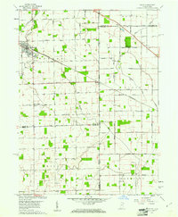
1960 Map of Dixon
USGS Topo · Published 1963About this map
The Indiana Ohio State Line serves as the central axis for this 1960 survey, bisecting a landscape defined by precise section lines and the diverging paths of Flatrock Creek and Blue Creek. Along the northern edge, Monroeville appears as a significant rail-connected hub, while the hamlet of Dixon straddles the state boundary itself. The region’s rural heritage is densely documented through numerous family and community landmarks, such as the Odd Fellows Cem, Hoffman Cem, and Alpha Cem. The presence of several country churches, including Walnut Grove Ch and Bethlehem Ch, underscores the established social fabric of Monroe and Tully townships. This map is particularly valuable for genealogists, as it meticulously labels smaller settlements like Wolfcale and East Liberty alongside a high concentration of named cemeteries and church sites that often served as the cornerstones of local identity in the mid-20th century.
Find a feature on this map
28 named features on this map. Tap any name to fly to it.
Don’t see what you’re looking for? This feature index may not catch every label — zoom into the map to look around manually.
Map Details
Editions of this 1960 Dixon Map
5 editions found


Other maps of this area

1914 · Van Wert
USGS Topo · 1:62,500

1914 · Paulding
USGS Topo · 1:62,500

1944 · Van Wert
USGS Topo · 1:62,500

1944 · Paulding
USGS Topo · 1:62,500

1953 · Fort Wayne
USGS Topo · 1:250,000

1953 · Muncie
USGS Topo · 1:250,000

1956 · Muncie
USGS Topo · 1:250,000

1956 · Fort Wayne
USGS Topo · 1:250,000

1957 · Maples
USGS Topo · 1:24,000

1958 · Woodburn South
USGS Topo · 1:24,000