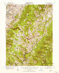
1957 Map of Donegal
USGS Topo · Published 1957About this map
Norvelt, a planned New Deal community, sits in the northwestern corner of this study, reflecting the unique social history of western Pennsylvania during the mid-20th century. The landscape is defined by the transition between the rolling hills of Mount Pleasant and the rising elevations of Chestnut Ridge, where scattered hamlets like Stahlstown and Donegal serve as anchors for the rural population. The southern portion of the map reveals an industrial and transit corridor following Indian Creek, where the Baltimore and Ohio railroad tracks connect mining and timber settlements such as Melcroft, Sagamore, and Indian Head. Local life is documented through the density of country churches and small schoolhouses, including St Boniface Chapel and the Hurst High School, while landmarks like Weaver Mill and Kovners Mill point to the region's earlier water-powered economy along Loyalhanna Creek and its tributaries.
Find a feature on this map
103 named features on this map. Tap any name to fly to it.
Don’t see what you’re looking for? This feature index may not catch every label — zoom into the map to look around manually.
Map Details
Editions of this 1957 Donegal Map
2 editions found
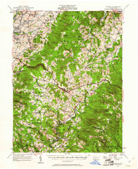
Other maps of this area

1900 · Uniontown
USGS Topo · 1:62,500

1900 · Latrobe
USGS Topo · 1:62,500

1902 · Latrobe
USGS Topo · 1:62,500

1902 · Connellsville
USGS Topo · 1:62,500

1903 · Latrobe
USGS Topo · 1:62,500

1904 · Greensburg
USGS Topo · 1:62,500

1906 · Greensburg
USGS Topo · 1:62,500

1913 · Somerset
USGS Topo · 1:62,500

1915 · Somerset
USGS Topo · 1:62,500

1920 · New Florence
USGS Topo · 1:62,500