
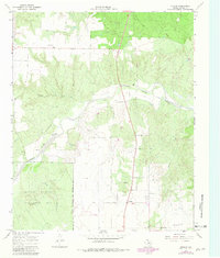
1967 Map of Dunlap
USGS Topo · Published 1969About this map
Middle Pease River winds through the heart of this Cottle County landscape, carving a wide bed across the terrain. The small community of Dunlap serves as a central point of reference, situated just south of where a local Roadside Park and several wells are marked. To the southwest, the Matador Wildlife Management Area occupies a significant portion of the sheet, its boundary clearly defined as it meets the rugged drainages of Ox Creek and Bluff Creek.
Find a feature on this map
13 named features on this map. Tap any name to fly to it.
Don’t see what you’re looking for? This feature index may not catch every label — zoom into the map to look around manually.
Map Details
Editions of this 1967 Dunlap Map
2 editions found
Other maps of this area

1954 · Plainview
USGS Topo · 1:250,000

1958 · Plainview
USGS Topo · 1:250,000

1966 · Cee Vee
USGS Topo · 1:24,000

1966 · Devils Canyon
USGS Topo · 1:24,000

1967 · Buckle L Ranch
USGS Topo · 1:24,000

1967 · Tell South
USGS Topo · 1:24,000

1967 · Hell Roaring Creek
USGS Topo · 1:24,000

1967 · Paducah
USGS Topo · 1:24,000

1967 · Moons Camp
USGS Topo · 1:24,000
1967 · Swearingen
USGS Topo · 1:24,000