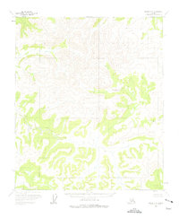
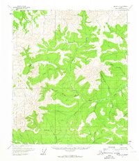
1956 Map of Eagle C-5
USGS Topo · Published 1975About this map
The Fairbanks Meridian area of the Alaska interior is documented here as it appeared in the mid-1950s, shortly after the Bureau of Land Management predetermined unsurveyed and unmarked land lines for the region. The landscape is dominated by complex high-altitude drainage systems and unnamed peaks, with elevations frequently exceeding 5,000 feet. Ruby Creek serves as the primary named hydrological feature on this sheet, flowing through the eastern reaches of the quadrangle. The lack of established roads, trails, or settlements at the time of the 1956 field annotation emphasizes the isolation of this portion of the Eagle district, prior to more intensive exploration or infrastructure development in the territory.
Find a feature on this map
1 named feature on this map. Tap any name to fly to it.
Don’t see what you’re looking for? This feature index may not catch every label — zoom into the map to look around manually.
Map Details
Editions of this 1956 Eagle C-5 Map
2 editions found
Other maps of this area

1951 · Eagle
USGS Topo · 1:250,000

1956 · Eagle B-5
USGS Topo · 1:63,360

1956 · Eagle B-4
USGS Topo · 1:63,360
1956 · Eagle D-5
USGS Topo · 1:63,360

1956 · Eagle C-6
USGS Topo · 1:63,360
1956 · Eagle D-4
USGS Topo · 1:63,360

1956 · Eagle B-6
USGS Topo · 1:63,360

1956 · Eagle C-5
USGS Topo · 1:63,360
1956 · Eagle D-6
USGS Topo · 1:63,360
1956 · Eagle C-4
USGS Topo · 1:63,360