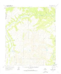
1956 Map of Eagle D-6
USGS Topo · Published 1974About this map
The Charley River dominates the eastern drainage of this interior Alaskan wilderness, as documented during the mid-1950s. The landscape is defined by its dramatic elevation changes and a sophisticated network of waterways including Crescent Creek and Beverly Creek. Unlike more settled regions, this area shows no established roads or trails at the time of the survey, instead highlighting the raw topography of peaks like Bev 3674 and Cut 4435. The western edge of the map identifies the boundary of the Fairbanks North Star Borough, while the central portion is bisected by a formal Base Line. This survey serves as a vital record of the unsurveyed and unmarked land lines as predetermined by the Bureau of Land Management, providing a clear view of the natural hydrology of Moraine Creek before modern intervention.
Find a feature on this map
8 named features on this map. Tap any name to fly to it.
Don’t see what you’re looking for? This feature index may not catch every label — zoom into the map to look around manually.
Map Details
Editions of this 1956 Eagle D-6 Map
2 editions found
Other maps of this area

1950 · Big Delta
USGS Topo · 1:250,000

1951 · Big Delta
USGS Topo · 1:250,000

1951 · Charley River
USGS Topo · 1:250,000

1951 · Eagle
USGS Topo · 1:250,000

1951 · Circle
USGS Topo · 1:250,000

1955 · Circle A-1
USGS Topo · 1:63,360

1955 · Circle
USGS Topo · 1:250,000

1956 · Charley River A-5
USGS Topo · 1:63,360

1956 · Charley River A-6
USGS Topo · 1:63,360

1956 · Charley River
USGS Topo · 1:250,000