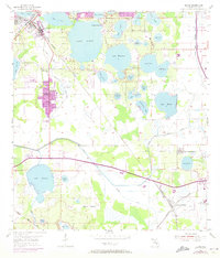
1955 Map of Eloise
USGS Topo · Published 1973About this map
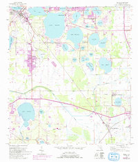
Cypress Gardens serves as a prominent landmark in this citrus-heavy landscape, bordering the expansive waters of Lake Eloise. The map illustrates a region transitioning from mid-century rural groves to growing residential pockets, with the town of Eloise and its industrial rail sidings visible alongside Lake Shipp. The Seaboard Coast Line railroad cuts diagonally across the terrain, connecting established settlements like Wahneta and Alturas to the wider Florida network.
Find a feature on this map
44 named features on this map. Tap any name to fly to it.
Don’t see what you’re looking for? This feature index may not catch every label — zoom into the map to look around manually.
Map Details
Editions of this 1955 Eloise Map
6 editions found
Other maps of this area

1944 · Auburndale
USGS Topo · 1:31,680

1949 · Bartow
USGS Topo · 1:24,000

1950 · Bartow
USGS Topo · 1:24,000

1952 · Homeland
USGS Topo · 1:24,000

1952 · Lake Wales
USGS Topo · 1:24,000

1952 · Babson Park
USGS Topo · 1:24,000

1953 · Dundee
USGS Topo · 1:24,000

1955 · Eloise
USGS Topo · 1:24,000

1955 · Alturas
USGS Topo · 1:24,000

1955 · Orlando
USGS Topo · 1:250,000