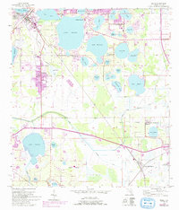
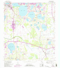
1955 Map of Eloise
USGS Topo · Published 1993About this map
Cypress Gardens and an expansive network of interconnected lakes dominate this mid-century Florida landscape, revealing a region defined by its complex hydrology and early tourism development. The sheet captures the area as residential and industrial patterns solidified around the Seaboard Coast Line railroad and the Peace Creek Drainage Canal. Large citrus groves and agricultural plots are visible surrounding established communities like Eloise and Wahneta, while smaller settlements such as Floritan and West Scenic Park sit near the eastern edge. Local social life is evidenced by the Southland Ch and Rifle Range Ch, while more specialized land uses appear at the Fish Hatchery and a small Airfield. The transition from natural wetlands to managed waterways is clear through the numerous named lakes, including Lake Eloise, Lake Winterset, and Lake Garfield.
Find a feature on this map
50 named features on this map. Tap any name to fly to it.
Don’t see what you’re looking for? This feature index may not catch every label — zoom into the map to look around manually.
Map Details
Editions of this 1955 Eloise Map
6 editions found
Other maps of this area

1944 · Auburndale
USGS Topo · 1:31,680

1949 · Bartow
USGS Topo · 1:24,000

1950 · Bartow
USGS Topo · 1:24,000

1952 · Homeland
USGS Topo · 1:24,000

1952 · Lake Wales
USGS Topo · 1:24,000

1952 · Babson Park
USGS Topo · 1:24,000

1953 · Dundee
USGS Topo · 1:24,000

1955 · Eloise
USGS Topo · 1:24,000

1955 · Alturas
USGS Topo · 1:24,000

1955 · Orlando
USGS Topo · 1:250,000