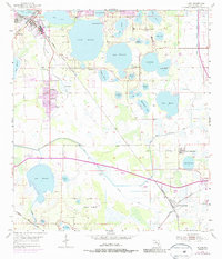
1955 Map of Eloise
USGS Topo · Published 1987About this map
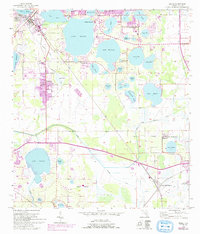
Cypress Gardens stands as a primary destination in this mid-century Florida landscape, surrounded by an intricate chain of lakes. The topography is dominated by water, with Lake Eloise, Lake Winterset, and Lake Garfield defining the settlement patterns and citrus groves of Polk County. The Seaboard Coast Line railroad cuts diagonally across the terrain, linking the industrial and residential centers of Eloise and Wahneta to the wider region.
Find a feature on this map
48 named features on this map. Tap any name to fly to it.
Don’t see what you’re looking for? This feature index may not catch every label — zoom into the map to look around manually.
Map Details
Editions of this 1955 Eloise Map
6 editions found
Other maps of this area

1944 · Auburndale
USGS Topo · 1:31,680

1949 · Bartow
USGS Topo · 1:24,000

1950 · Bartow
USGS Topo · 1:24,000

1952 · Homeland
USGS Topo · 1:24,000

1952 · Lake Wales
USGS Topo · 1:24,000

1952 · Babson Park
USGS Topo · 1:24,000

1953 · Dundee
USGS Topo · 1:24,000

1955 · Eloise
USGS Topo · 1:24,000

1955 · Alturas
USGS Topo · 1:24,000

1955 · Orlando
USGS Topo · 1:250,000