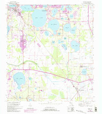
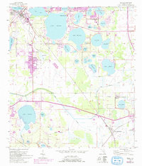
1955 Map of Eloise
USGS Topo · Published 1993About this map
The famed botanical landscape of Cypress Gardens anchors this mid-century survey of the Florida interior, situated within a dense network of freshwater basins including Lake Eloise, Lake Winterset, and Lake Ruby. The area shows a specialized agricultural and recreational economy, defined by the extensive citrus groves and residential expansion near Eloise and Wahneta. Civil infrastructure is prominently recorded, from the Fish Hatchery and Rifle Range to the industrial utility of the Seaboard Coast Line railroad and Wahneta Farms Road.
Find a feature on this map
48 named features on this map. Tap any name to fly to it.
Don’t see what you’re looking for? This feature index may not catch every label — zoom into the map to look around manually.
Map Details
Editions of this 1955 Eloise Map
6 editions found
Other maps of this area

1944 · Auburndale
USGS Topo · 1:31,680

1949 · Bartow
USGS Topo · 1:24,000

1950 · Bartow
USGS Topo · 1:24,000

1952 · Homeland
USGS Topo · 1:24,000

1952 · Lake Wales
USGS Topo · 1:24,000

1952 · Babson Park
USGS Topo · 1:24,000

1953 · Dundee
USGS Topo · 1:24,000

1955 · Eloise
USGS Topo · 1:24,000

1955 · Alturas
USGS Topo · 1:24,000

1955 · Orlando
USGS Topo · 1:250,000