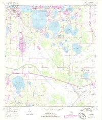
1955 Map of Eloise
USGS Topo · Published 1988About this map
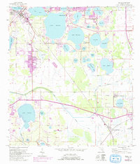
Cypress Gardens stands as a primary landmark in this Central Florida landscape, surrounded by a dense network of lakes including Lake Eloise, Lake Winterset, and Lake Ruby. The map documents a period of postwar growth, with expanded urban areas in Eloise and Wahneta shown in purple revision tints from the 1980s over the original 1950s topography. The eastern banks of the Peace River meander through the center of the sheet, providing a natural drainage corridor for the region's many water bodies.
Find a feature on this map
48 named features on this map. Tap any name to fly to it.
Don’t see what you’re looking for? This feature index may not catch every label — zoom into the map to look around manually.
Map Details
Editions of this 1955 Eloise Map
6 editions found
Other maps of this area

1944 · Auburndale
USGS Topo · 1:31,680

1949 · Bartow
USGS Topo · 1:24,000

1950 · Bartow
USGS Topo · 1:24,000

1952 · Homeland
USGS Topo · 1:24,000

1952 · Lake Wales
USGS Topo · 1:24,000

1952 · Babson Park
USGS Topo · 1:24,000

1953 · Dundee
USGS Topo · 1:24,000

1955 · Eloise
USGS Topo · 1:24,000

1955 · Alturas
USGS Topo · 1:24,000

1955 · Orlando
USGS Topo · 1:250,000