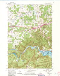
1954 Map of Esko
USGS Topo · Published 1983About this map
Jay Cooke State Park dominates the southern landscape of this survey, where the St Louis River carves a winding path toward the Duluth city boundary. This corridor is defined by its industrial and recreational infrastructure, featuring a ski tow and ski jump near Elys Peak, alongside numerous gravel pits and a quarry. The settlement pattern reflects the area's cultural heritage, notably marked by the Finnish Ch and Augustana Ch, while the town of Esko serves as a central hub.
Find a feature on this map
48 named features on this map. Tap any name to fly to it.
Don’t see what you’re looking for? This feature index may not catch every label — zoom into the map to look around manually.
Map Details
Editions of this 1954 Esko Map
5 editions found

Other maps of this area

1895 · Duluth
USGS Topo · 1:62,500

1915 · Superior
USGS Topo · 1:48,000

1917 · Superior
USGS Topo · 1:62,500

1953 · Saginaw
USGS Topo · 1:24,000

1953 · Adolph
USGS Topo · 1:24,000

1953 · Duluth Heights
USGS Topo · 1:24,000

1953 · Duluth
USGS Topo · 1:62,500

1953 · Duluth
USGS Topo · 1:250,000

1954 · West Duluth
USGS Topo · 1:24,000

1954 · Cloquet
USGS Topo · 1:24,000