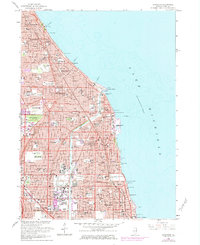
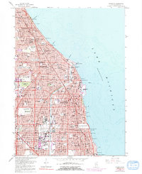
1963 Map of Evanston
USGS Topo · Published 1984About this map
The North Shore's suburban expansion is meticulously documented in this mid-century survey, ranging from Glencoe down through Evanston to the northern edge of Chicago. The landscape is defined by the Lake Michigan shoreline and a dense network of prestigious institutions, including the sprawling campus of Northwestern University and the iconic Bahai Temple. Residential growth is evident in the transition from established neighborhoods like Winnetka and Kenilworth to the rising developments in Skokie and Niles. Significant local landmarks such as the Grossepoint Lighthouse and the Hadley School for the Blind appear alongside numerous parochial schools and cemeteries like Calvary Cemetery. Transportation corridors are anchored by the Chicago And North Western railroad and the Edens Expressway, while leisure spaces like the Indian Hill Golf Club and the Drive-in Theater reflect the social character of the era.
Find a feature on this map
124 named features on this map. Tap any name to fly to it.
Don’t see what you’re looking for? This feature index may not catch every label — zoom into the map to look around manually.
Map Details
Editions of this 1963 Evanston Map
5 editions found
Other maps of this area

1889 · Chicago
USGS Topo · 1:62,500

1891 · Chicago
USGS Topo · 1:62,500

1891 · Riverside
USGS Topo · 1:62,500

1893 · Riverside
USGS Topo · 1:62,500

1899 · Evanston
USGS Topo · 1:62,500

1900 · Chicago
USGS Topo · 1:62,500

1900 · Riverside
USGS Topo · 1:62,500

1900 · Highwood
USGS Topo · 1:62,500

1901 · Riverside
USGS Topo · 1:62,500

1901 · Chicago
USGS Topo · 1:62,500