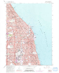
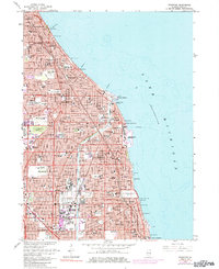
1963 Map of Evanston
USGS Topo · Published 1991About this map
Lake Michigan's western shoreline serves as the defining boundary for this urban corridor, where the residential and institutional development of the North Shore is captured in significant detail. The map reveals the intricate transit web connecting these lakeshore communities, featuring the Chicago and North Western and Chicago Transit Authority lines alongside Sheridan Road. This era shows the mature growth of educational centers like Northwestern University and Loyola University, as well as specialized institutions such as the Hadley School for the Blind. The transition from the dense street grids of Chicago and Evanston to the sprawling estates of Kenilworth and Winnetka is evident. Local history is preserved through the locations of numerous parish schools like St Joseph Sch and the expansive grounds of Calvary Cemetery, while landmarks like the Grossepoint Lighthouse mark the nautical edge of Wilmette Harbor.
Find a feature on this map
98 named features on this map. Tap any name to fly to it.
Don’t see what you’re looking for? This feature index may not catch every label — zoom into the map to look around manually.
Map Details
Editions of this 1963 Evanston Map
5 editions found
Other maps of this area

1889 · Chicago
USGS Topo · 1:62,500

1891 · Chicago
USGS Topo · 1:62,500

1891 · Riverside
USGS Topo · 1:62,500

1893 · Riverside
USGS Topo · 1:62,500

1899 · Evanston
USGS Topo · 1:62,500

1900 · Chicago
USGS Topo · 1:62,500

1900 · Riverside
USGS Topo · 1:62,500

1900 · Highwood
USGS Topo · 1:62,500

1901 · Riverside
USGS Topo · 1:62,500

1901 · Chicago
USGS Topo · 1:62,500